Neighbourhood Boundaries
Neighbourhood Boundaries for Canada 2024
Major Markets
Sub Neighbourhood, Parent Neighbourhood,
Community, Hamlet and Small Settlement Polygons
Formats: tab, shp
Coverage: Regional - Major Markets
Datum: WGS84
Records: 10,000
Year: 2025
Contact us for licensing options
Neighbourhood Boundaries for Canada Major Markets 2025 is a highly detailed, up-to-date neighbourhood boundary product covering selected major metropolitan, urban and rural market areas in Canada. The database is compiled utilizing a variety of administrative data resources and cross validation methods including federal, provincial and municipal government sources, civic subdivision plans, secondary plans, active development plans, local identity information, official locality names, neighbourhood association descriptions, aerial imagery, interpolated property lines, cadastral data, natural neighbourhoods, settlement clusters, street network, access routes, designated place names, ground and field research, cartographic, historical and topographical references.
The database includes sub neighbourhoods (new survey developments, subdivisions, mobile home / trailer parks, golf / ski / marina communities, school campuses, military bases, housing projects, etc.), parent neighbourhoods (municipal-level neighbourhood planning districts), census subdivision name, census subdivision code, census subdivision type, census metropolitan area, census metropolitan area code, province and province code.
Neighbourhood boundaries are highly useful for real estate profiling, realtor web applications, geo-fencing, mobile media, out of home marketing applications, advertising, health care planning, community services, municipal planning, business improvement areas, community improvement plans, economic development, neighbourhood associations, fundraising campaigns, retail location, micro-level target marketing, demographic analysis and cartographic base mapping.
Variables: Sub Neighbourhood, Parent Neighbourhood, Neighbourhood Type, Census Subdivision (CSD), CSD Code, Province, Province Code.
Market Coverage: Greater Toronto Area, Greater Montreal / Laval, Longueuil, Greater Vancouver / Lower Mainland, West Vancouver, North Vancouver, Richmond, White Rock, Surrey, Langley, Port Coquitlam, Port Moody, Langley, Deep Cove, Horseshoe Bay, Burnaby, New Westminster, Harrison Hot Springs, Delta, Abbotsford, Chilliwack, Ottawa / Gatineau, Aylmer, Pontiac, Chelsea, Cantley, La Pêche, L'Ange-Gardien, Val-des-Monts, Buckingham, Masson-Angers, Bellevue, National Capital Region, Halifax Dartmouth, Colville, Bedford, Sackville, Head of Saint Margarets Bay, Peggy's Cove, Calgary, Edmonton, Regina, Moose Jaw, Battleford, Bolton, Vaughan, Brampton, Mississauga, Oakville, Burlington, Waterdown, Flamborough, Freelton, Campbellville, Dundas, Ancaster, Mope Hope, Jerseyville, Milton, Georgetown, Orangeville, Alliston, Bond Head, Angus, Markham, Pickering, Whitby, Ajax, Oshawa, Bowmanville, Clarington, Uxbridge, Port Perry, York Region, Richmond Hill, Aurora, Newmarket, Bradford, Innisfil, Georgina, Keswick, Pefferlaw, Hamilton / Niagara, Mount Hope, Dundas, Ancaster, Stoney Creek, Grimsby, Beamsville, Port Dalhousie, Nanticoke, Binbrook, Niagara Falls, Niagara-on-the-Lake, Virgil, St. Catharines, Fonthill, Smithville, Thorold, Welland, Port Colborne, Fort Erie, Wainfleet, Haldimand, Kitchener, Waterloo, Cambridge, Woolrich, Guelph, Puslinch, Freelton, Brantford, Paris, Ayr, London, Windsor, Amherstburg, La Salle, Tecumseh, Kingsville, Leamington, Essex, Lakeshore, Central Ontario, Simcoe, Barrie, Orillia, Warminster, Port Severn, Honey Harbour, Port McNicoll, Victoria Harbour, Tiny Beaches, Midland, Penetanguishene, Wasaga Beach, Stayner, Collingwood, The Blue Mountains, Grey County, Craigleith, Clarksburg, Beaver Valley, Thornbury.

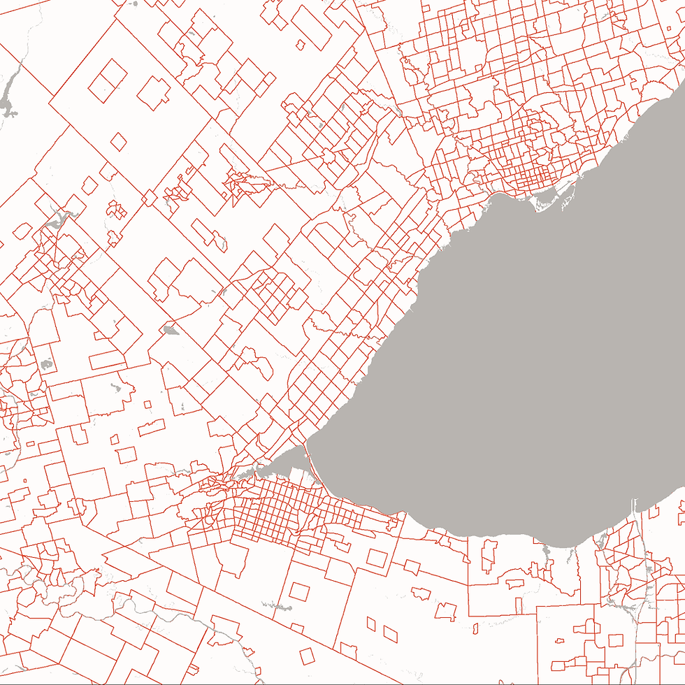
Neighborhood Boundaries, Small Settlement Areas and Hamlets

Neighbourhood Boundaries for Toronto GTA

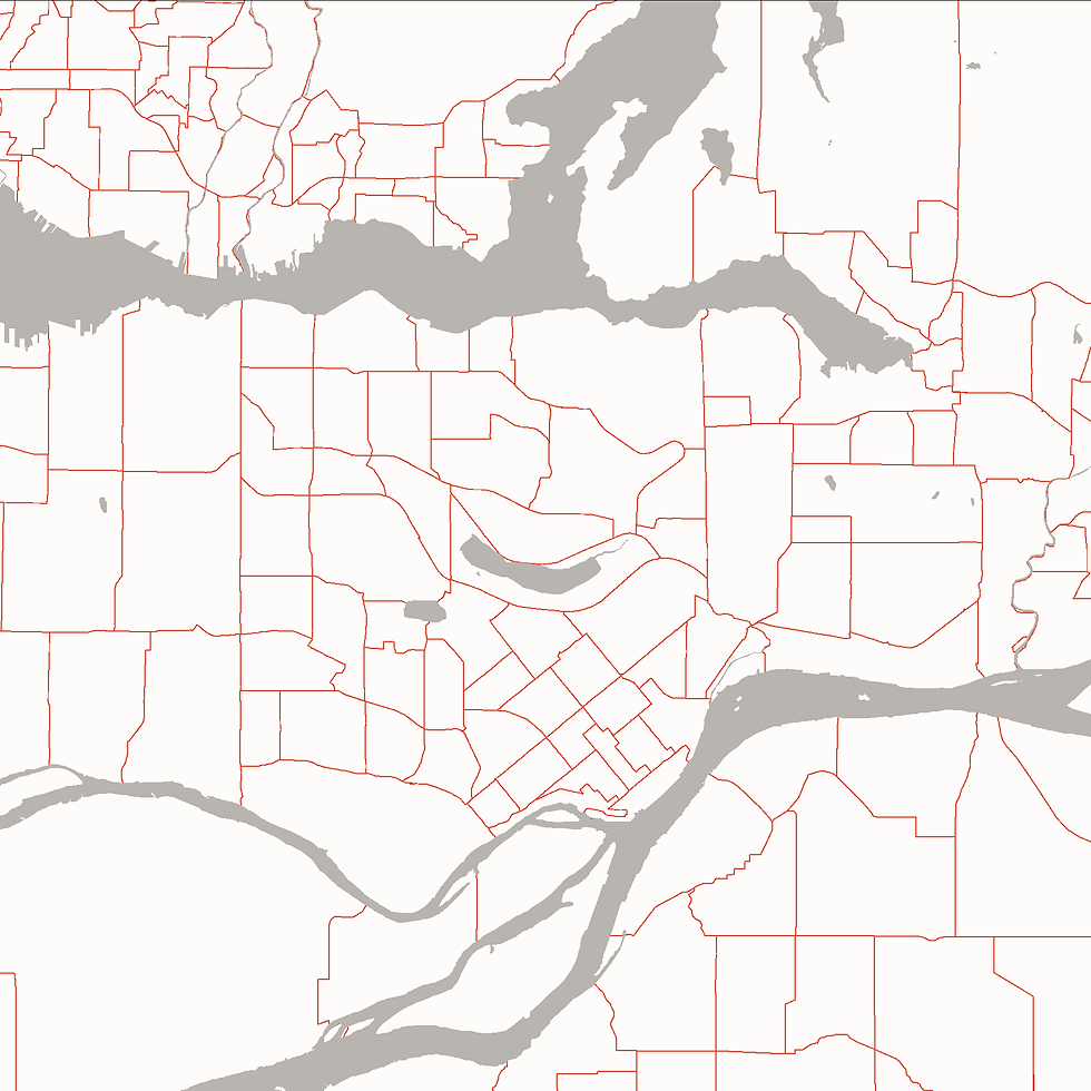
Vancouver Lower Mainland Neighborhood Boundaries

Neighborhood Boundaries, Small Settlement Areas and Hamlets

